The idea for this blog post came to me after I presented a short webinar on the mapping and drawing application Cartograf last week. Previously I had published a post about Cartograf’s incredible power for subjects like History and Geography. But interestingly my web event attracted educators from a variety of different subject areas. I thought, why such broad interest in a mapping application? What relevance did it have for them? I wanted to find out more, so I gathered together a few friends from different domains to brainstorm some potential uses for Cartograf (and for geographic skills in general) in subjects other than secondary Geography and History.
Over a few days I interviewed or corresponded with:
- Annie-Claude Valois, Consultant for F.L.S (French) from RSB
- Sylwia Bielec, Consultant for the Arts from LEARN
- Anne-Marie Desilva, Consultant for ERC (Ethic and Religious Education) from EMSB
- Susan Van Gelder , Consultant for ELA (English) at LEARN
- Craig Bullet, RECIT and SS (Social Sciences) consultant for the ESSB
Below are not exact quotes from our exchanges, but rather short paraphrases of some of the suggestions they made.
![]()
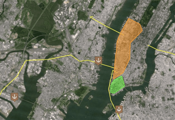
Location, location, location

Paul: Is location important for your subject area? Why should students in your subject know where things are taking place, where things are made, created, written, imagined? In Cartograf you can mark precise points on the globe, and within that “marker” you can provide or they can interpret information in the form of texts, images, even videos. But why should students care about the where?
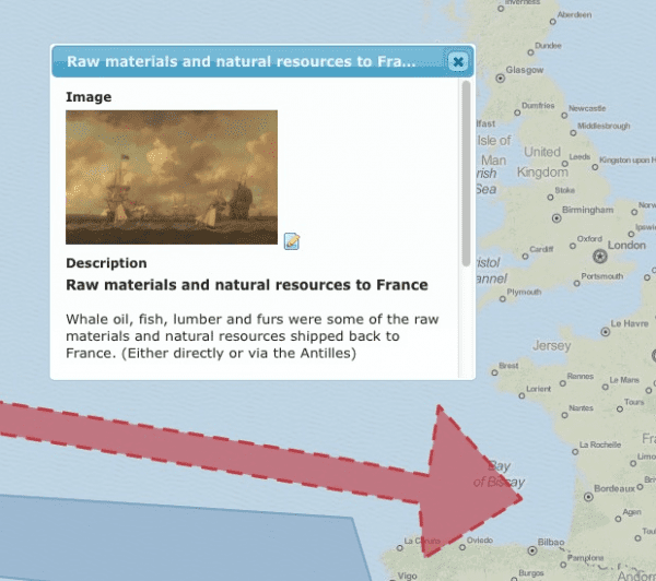
Annie-Claude (FLS): In French it is very important for students to learn about Francophone culture, from here but also from around the world. Students often read stories that take place elsewhere, or do a formal report on a topic external to Canada, like war, or poverty. Cartograf and the use of Google Satellite view could help students actually see where things happened or where they are happening now.
Craig (SS): In elementary cycle 1 students learn to construct and represent their space, by mapping simple things like their neighbourhood, key buildings, etc. Cartograf markers could be used to identify these places even at young ages. Images in the markers could help teachers convey information. In their History courses students could tag specific locations too. For the explorers to New France students could mark where they came from and also where they landed and later settled.
Sylwia (Arts): If you believe art history is important and are a teacher that likes to provide historical contexts for art, then location is important. Consider a group like the Impressionists and how learning about where and when they painted will provide a context for what and how they painted. Location can also be seen an impetus to create. For example, geographically-based conflicts or events have often inspired artists to create works based on their reaction or interpretation of the situation. Showing students the location of the conflicts, with specific examples using the marker tools in Cartograf, could inspire them to respond to those conflicts or events themselves. They could also mirror the process and seek out local issues that are important to them and use those as an impetus for creation.
Anne-Marie (ERC): Location is essential to understanding religions and religious culture. In the elementary program students need to know how to locate religions in their society and also around the world. For example they need to understand which countries are predominantly Muslim, Christian, and so on. They also need to understand information about those countries, like whether state and religion are separate entities. Students learn also about the founders of religions, so marker points in Cartograf could include information about those individuals, where they were born, how they lived, as well as where and how they founded a religion. Similarly, students learn about famous religious places. Cathedrals, mosques, temples of course, but also sacred regions like Jerusalem. An explanation of why a site is important to a particular religion could be added to a marker, an image or even a Streetview panorama could provide more information about that site today.
Susan (ELA): One might forget that in English we often read books from authors outside of Canada. When reading literature from other countries, students could locate specific scenes on a map, and include images and texts to help them flesh out an understanding of the area. Similarly, when learning about the authors themselves, students could mark locations for them too. Have the authors travelled? Has this influenced their writing? Learn about where they live and how this might relate to their stories. As a class, using the share codes in Cartograf, we could even build up a common map of the authors we’ve read.
![]()
Leaving a trace
Paul: Could tracing routes or delineating territory be useful? In Cartograf you can draw simple maps, lines and shapes that delineate borders, land use, relationships between territories? Could these type of cartographic skills come into play in a learning scenario in your subject area?
Annie-Claude (FLS): Some stories are complex geographically, like one about a Quebecois child, whose parents are of Haitian descent, whereas his grandparents were African slaves. Using Cartograf we could mark the origins of the family and trace their voyage, their immigrant experience, from one place to another.
Sylwia (Arts): To understand art sometimes we need to understand schools of art, as they existed in a geographic area. Think about the Bauhaus movement and the particular German cities in which it developed, the regions in which it took place. Or think of Rome and the religious art that developed around and along lines marked by the spread of Catholicism. Students could learn about these types of art and influence through simple maps, or they could trace equivalent patterns of influence today on maps of their own? These sort of activities could help springboard them towards finding their own “religion equivalent” if you will, their own artistic movement to follow.
 Anne-Marie (ERC): At the secondary level students could enhance their understanding of religions by plotting the routes of famous pilgrimages! Cartograf’s ability to include information in shapes means the route could be explained at each stage. Another common activity asks students to trace religions down through time, to show how they from one place to another. Again, information added to each line and shape could note why people moved, how and why beliefs spread and transformed. Think of the silk roads, think of historical contexts like the Crusades or the spread and retreats of Islam. And even for the Ethics competencies I think simple maps could be used, to help delineate differences between one country to the next, as concerns children’s rights for example, or perhaps the legality of homosexuals. Even ethical issues stemming from certain events, like the movement and acceptance of refugees, could also be better explored by tracing maps of their routes and of their origins.
Susan (ELA): Often the storyline of a book takes us to a variety of places. Using Cartograf students could trace the routes that different characters take. Call it a Cartograf lit trip! Think about books like Underground to Canada, Walk Two Moons, or the Grapes of Wrath. Sometimes the routes taken are almost as important as the development of character or plot. Keep in mind too that knowing how to read maps, images, any sort of media or graphic representation, all that could be considered part of ELA too. “Texts” are much more than just words.
![]()
Does an image paint a thousand words?
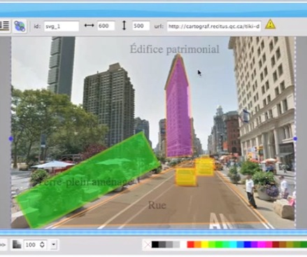
Paul: Cartograf also contains powerful ways to use and analyze images. Photographs can be localized and explained inside a marker point (i.e. “attached” and thus geolocalized to a specific location, a city, a street corner, a cliff side, a mountain top, anywhere on the globe.) You can also access Google Street panoramas, and insert actual street-level imagery and point of views for consideration, maybe for comparison. And what is more, you can even sketch on top of images, labeling, tracing shapes, adjusting transparency, using advance drawing tools right in the application. Could you use images in any of these ways? What type of learning activities could students do using Cartograf’s image analysis tools?
Annie-Claude (FLS): We often use images during activities where we pose questions to students. Sometimes students also use images in order to make predictions. Images inside localized points on maps could inspire other questions about location and the environment as well.
Sylwia (Arts): Google Streetview in Cartograf could be used to find and display works of art that are relatively permanent, like a graffiti by someone like Banksy for example! Or a series of graffiti examples could demonstrate a general street art movement. Murals on buildings in certain cities, in certain countries, could also be tagged and explained, in terms of location, but also in terms of culture, or local social issues. In Competency 3 students appreciate an image, and must talk about it in terms of things like artistic techniques. Certainly the drawing tools could be used to help identify techniques in images they attach to points, the play of light and shadow, pointillism, etc. As an actual creation tool I am not sure though. When it comes to using technology, multimedia art teachers are more likely to introduce their students to more specialized drawing or photo editing software, like Photoshop.
Anne-Marie (ERC): Religious places could be compared by using Cartograf’s image editor, to combine and compare images, like now-and-then image pairs, or uploaded photographs juxtaposed or overlapped with streetview images. Religious art could also be labelled and thus explored, in terms of location yes, but also as concerns their meaning or significance. For example, for Michelangelo’s David, you could include it in a point where it was created, then place it again where it stands now, and then make an analysis of the statue using text and drawing tools as well. Of course there is also religious architecture, its identifying features and making an analysis of individual differences as it appears in different locations. And finally, at specific sites, or as part of specific cultures, students often identify and analyze religious expressions, like an object, or the way someone prays to express their faith. Using a tool that also helps localize the religious expression can only help to explain them, to show differences and to show contexts. For example, an object in a Montreal mosque might be compared to one in a Saudi mosque using two images in marker points at their respective locations.
![]()
But why bother learning geographically? What is the “place value”!?
Paul: Okay, I always understood that our world is… “a complex battleground of physical and human interactions. [And that] Local is no longer local, but a collision point for the interaction of many ‘locals’ drawn from a global stage.” (Tony Cassidy) But after these few conversations and brainstorming sessions (thanks folks!) I also discovered that what we learn, in pretty much every subject area we learn, is only about our little corner of the world insomuch as it relates to everyone else’s. Everything has relative place value.
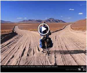 That being said, the question I still asked myself at the end the day was why? Or for me specifically, why should my son, who is about to graduate high school, care about where things are? I found some of my answers in how these short reflections show that geography, and the maps we live by, help us understand who we are and what we know, in pretty much every way we learn. But then I also stumbled on an excellent little video I thought I’d share to end this post, by (who else other than) National Geographic, called “Why is Geo-literacy Important?” Geo-literacy, it said, is basically about sufficiently informing the decisions we make (where sufficiently now also implies globally) so that we can better take action, and so our decisions are healthy, balanced and real in the global context in which we live. Pardon me? What? Where was all that said again? Well, in this case, right about here!
——————————-
Information on Cartograf:
CartoGraf is an interactive web-based mapping application to enhance learning in geography and history classes in schools and colleges. It is free and Open Source and produced by following partners: